THE STAGECOACH STOP ON PEASON RIDGE
BY RICKEY ROBERTSON
Looking back at means of travel in the United States, the stagecoach through the 1700's and 1800's was one of the most convenient ways to travel long distances. Stagecoaches were in great use until the coming of the mighty railroads that began to crisscross America with a faster way of travel. Throughout Louisiana there were many stagecoach routes, traces, trails and routes used by immigrants as they traveled westward in the Great Westward Migration and also for the movement of cattle and livestock from one area to another. One of the stagecoach routes came through present day Natchitoches, Sabine, and Vernon Parishes and came through the sand hills of Peason Ridge. The heyday for the stagecoach routes through our area was from 1840 to 1882. Sadly, over the many years, the location of the old Stage Stop had been nearly lost as so many of our older generations passed away. But they left us lots of good leads to follow. For many years I have slowly traced and found bits and pieces of the old stage route across this area. My goal was to try and find the old stagecoach stop location. And in December 2019, with the help of another Peason Ridge Heritage Family Member, Johnny Rivers, we located this historic location.
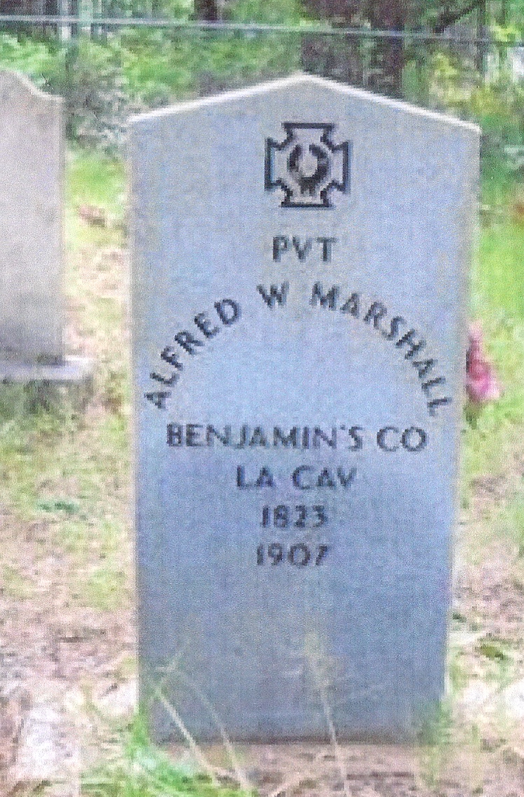
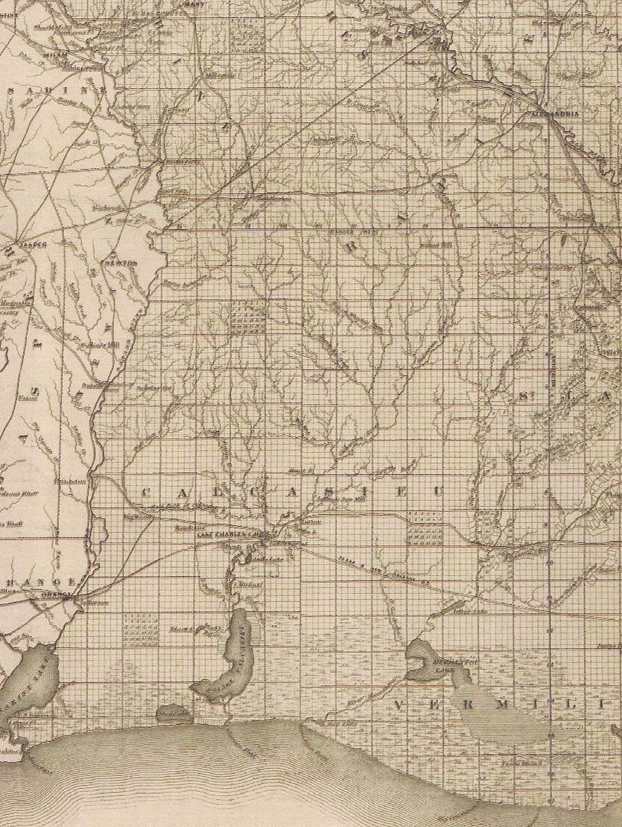
In western Louisiana the El Camino Real, the Kings Highway, ran from Mexico City all the way to Natchitoches, Louisiana, and was one of the oldest and well-known travel routes. The El Camino Real crossed the Sabine River near present-day Pendleton Bridge and several miles eastward toward Many, Louisiana a fork veered east/southeast and came through Sabine Parish and passed through the old town of Shake Hat, to old Bellwood, and over the Kisatchie Hills toward Chopin and on into Alexandria. At Natchitoches a road headed south and went to Opelousas and other points in South Louisiana. This road was known as the Opelousas Road and the trace coming from Sabine Parish joined it near Chopin and Monett's Ferry. The stagecoach route through Peason Ridge can be found where it crossed the Sabine River on an old 1863 Confederate Army map of western Louisiana. The route meandered its way across Peason Ridge to the Beasley Stage Stop located in the present-day Kisatchie National Forest near Red Dirt Wildlife Reservation. And from the Beasley Stage Stop the route ran over the Devil's Backbone, a series of rock ridges, and went to Natchitoches, the city located on the Red River. Talking with old timers over the years, I learned that the old route twisted and turned as it followed the sand ridges away from the baygalls and springs. One way the stage route was laid out was to take advantage of a location where two creeks joined, because downstream of this juncture downstream would usually be a sand bar that would allow for easier crossing. Good thinking, wasn't it! And a few of the crossings that could not be forded had small corduroy bridges build over them. Camille Key gave me some information about one of the stagecoach drivers who drove the stagecoach all through our area who had married into the Key Family of Kisatchie years ago. Alfred William Marshall married Avorilla Key in 1872 and they lived near the Beasley Stage Stop. As I researched Mr. Marshall I was able to find out that he would have known horses and mules well since he was a Confederate Cavalry veteran. And I was able to find out that he drove the route from the Beasley Stage Stop to Natchitoches, to Alexandria, through Peason Ridge, and his most distant travel ended up in San Augustine, Texas. He knew each and every route through our area as a driver.
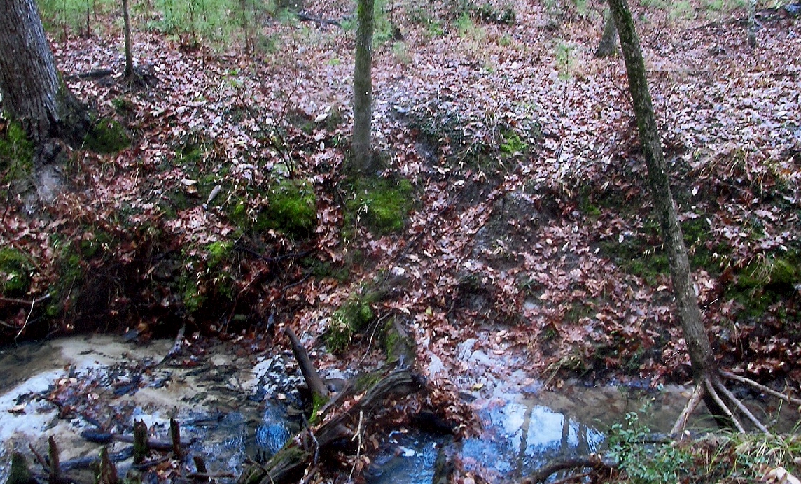
Johnny and I got together and traveled out to a location on Stage Stand Creek and parked. We walked a ways and you could tell that it was an old road bed of sorts and it was still visible. At Stage Stand Creek you could see where the road would have crossed the creek. Johnny mentioned that as a boy his father and mother and his uncles had talked of this location and had brought him to this site many years ago. At the location he was able to point out the area where the corrals had been located and I crossed over the creek and was able to find where the stock had once walked around and around the corral fences. It was a great place with available water. And where the stage stop building had once been located was a flat spot where you could tell a building had once stood. Near it, a sweet gum tree that still had the marks of old wire that had grown into it over the many years. And by the old route I had been tracing for years this was the location of the stage stop. And such a beautiful location! Such a beautiful running creek and a wonderful hardwood creek bottom. After we had walked around the location for a while, I could almost hear the sounds of horse hooves, the creak of leather, and the rattle of the incoming stage. An historic site once lost had been found again and photographed for remembrances forever. Our history lives on in locations such as this…and it is our duty never to lose the history made by our ancestors.
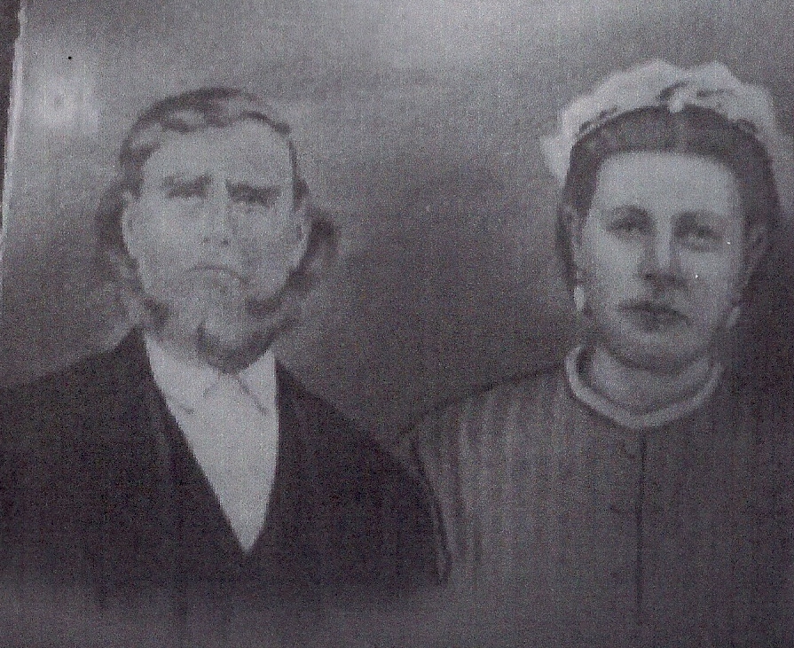
Alfred William Marshall and his wife, Avorilla Key, was one of the stage coach drivers on the many routes through the Kisatchie and Peason Ridge areas. (Camille Key photo)
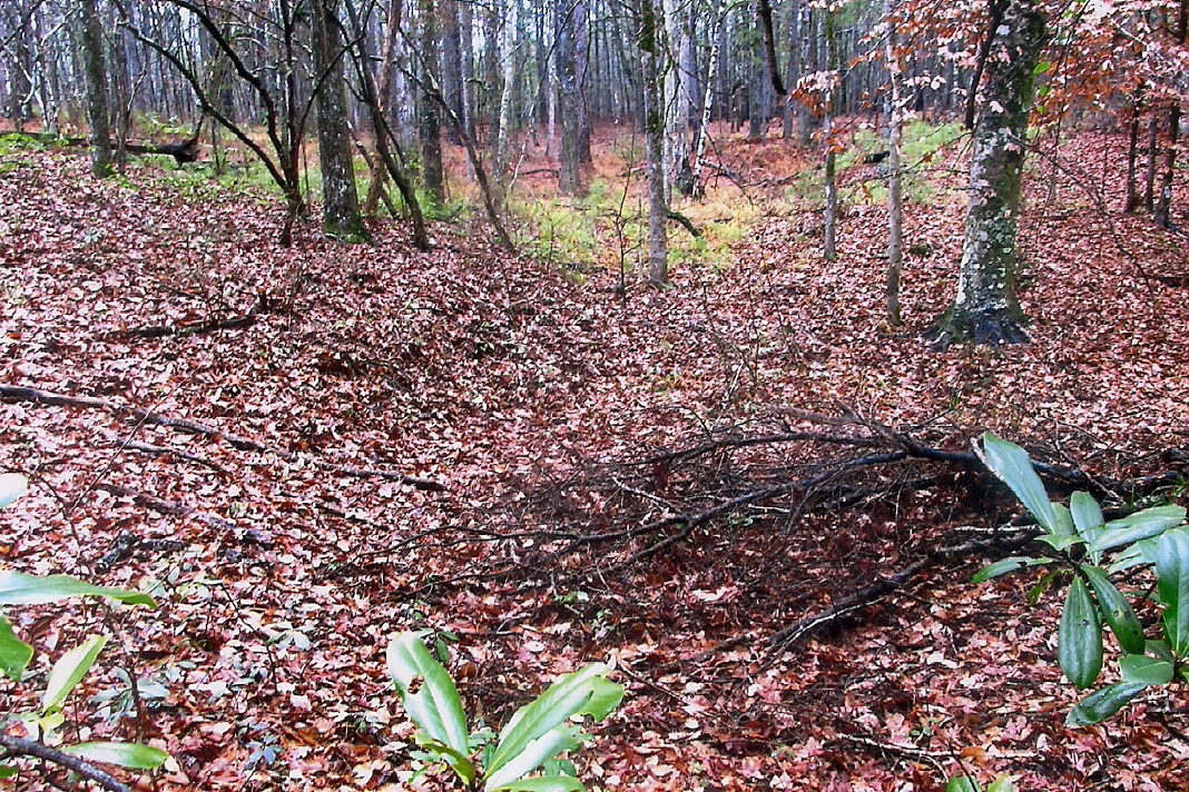
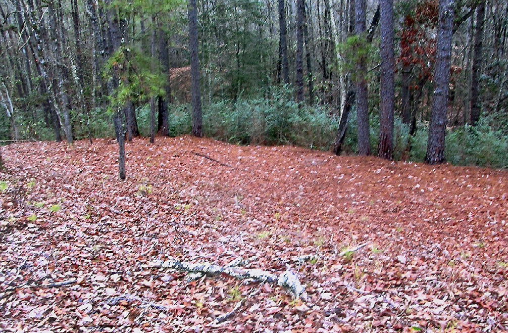
The location where the Stage Stop once sat on present day Peason Ridge. (Robertson photo)
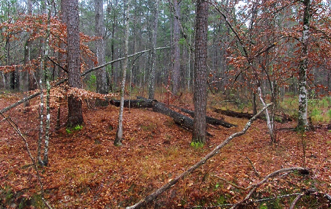
The location just across Stage Stand Creek where the corrals for the horses and mules had been located. You can still see where the stock had walked around the fences . (Robertson photo)
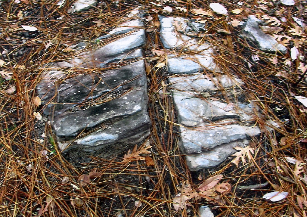
Along the old stage coach route are many rocks that still have the marks from the wagon wheels cut into them.
.jpg)