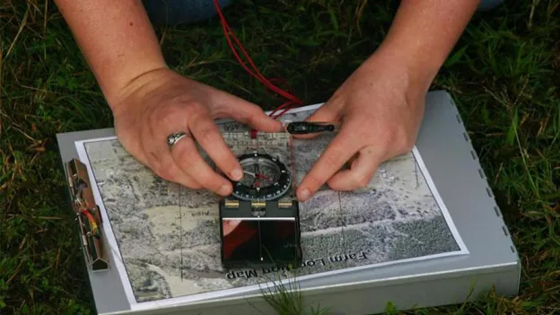
This concentration is offered within the Bachelor of Science in geospatial science program.
Map your future success
You’ll build a high-tech career by using advanced tools to define boundaries and map terrain relief for everything from private property to large-scale infrastructure projects. Your measurements will be used as the foundation for development and legal clarity as you utilize your technical expertise and legal knowledge to protect property rights and guide builders in the field.
Your path to licensure
This curriculum is dedicated to satisfy the academic requirements needed to begin your professional journey as a surveying candidate-in-training. You'll receive the specific legal and technical training required for state registration. Courses will focus on real estate law, oil and gas law and precise measurement techniques. It’s the direct route if your goal is to become a registered professional land surveyor or manage your own firm.
Precision in the field
This concentration combines essential spatial science theory with hands-on practice. Expect to gain experience with:
- Total station technology
- Auto level systems
- Laser rangefinders
- Professional mapping software
See curriculum
Requirements Degree mapDoes this program help me become licensed in Texas?
Yes, it fulfills the academic requirements to become a registered professional land surveyor in Texas.
Requirements for admission to SFA
All applicants must meet the undergraduate admission requirements. Select the option that best describes you:
- First-year student (have never enrolled in college)
- Transfer student (have enrolled in college)
- All other applicants
Ready to complete your application?
Undergraduate applications are accepted online. Apply using ApplyTexas or Common App. Both are fine, just only submit one.
Apply with ApplyTexas Apply with Common App
Priority deadlines
SFA has rolling admissions. That means you can apply to the university anytime. Although, applying early has financial and housing benefits. Make sure to check with your specific department! Some programs need extra paperwork by a certain date to consider you for the upcoming semester.
Related News


Questions?
Get in touch! We're here to help.
Department of Environmental and Geospatial Sciences
Human Services Building, Suite 312